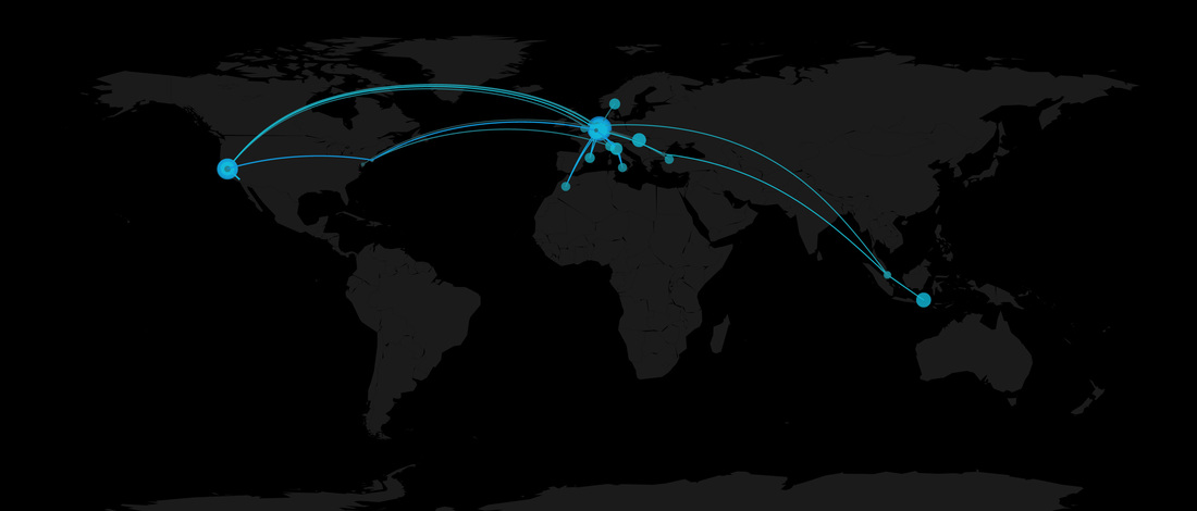
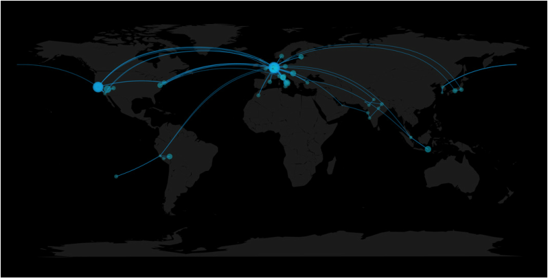
my geotagged pics in 2014 and between december 2011 and april 2015
For a while I wanted to map my flights and the locations I've spent time in throughout the year, so last night I downloaded my location data, which I thought I was tracking for a long time using a few apps. Unfortunately that was not the case. Turns out most apps were not running in the background, and I forgot to start others after rebooting my phone.
What to do? There's one thing I always do. Taking pictures. Everywhere. These days most pictures are geotagged, or at least the ones taken using smartphones. I found a couple of tutorials online on how to extract metadata from JPEGs in R and Python, and eventually worked with R since thanks to Nathan Yau and this post, I could make better looking maps. Another helpful post was on timelyportfolio, explaining how to extract exif metadata using exiftool and R. Quickstart
I haven't tested much the code, but if you are lucky, this should be sufficient to make your own map:
0 Comments
|
Marco ALtiniFounder of HRV4Training, Advisor @Oura , Guest Lecturer @VUamsterdam , Editor @ieeepervasive. PhD Data Science, 2x MSc: Sport Science, Computer Science Engineering. Runner Archives
May 2023
|
 RSS Feed